Friday, October 28, 2016

2016 East Coast Loop

We won't actually complete the 2016 Loop until December 31, 2016.  The last day of the year is the day we plan to move from Sun City (Phoenix, AZ area) to Yuma, AZ our last stop for the remainder of winter.  At the end of the loop we will have towed 7,624 miles, and approximately the same or a little more distance in the truck alone exploring each area we visited and completing the usual errands that we all have to do.  The original concept for the 2016 Loop included 6,795 miles, we ended up adding about 600 miles to that!

We also added a few more States Visited on this year's loop, and we generated a U.S. Map to represent and celebrate that accomplishment.  It isn't a simple thing to drive and tow 30,000 lbs of truck and trailer over the many road and topographical conditions.  With reasonable planning, preventive and corrective maintenance, lots of lubrication and plenty of luck, it's a piece of cake!  Another important point to mention, even though we have colored in many of the states, we have barely seen a fraction of what they have to offer in many of them.  While the drive through gave us a fine idea and feel for the general landscape of a state, at least in the regions we drove through, we still have much more to visit and see in most all of the places we have traveled.  And some of the great places we want a return visit!  There is just simply not enough time.

The States we added this year include: Arkansas, Tennessee, Ohio, Indiana, Michigan, Wisconsin, Minnesota, Iowa, Colorado and Utah.  We will need a Do Over for Indiana as we didn't actually stop in that State, we drove through a small part of the northeast corner en-route from Ohio to Michigan.  Many RVers travel and stop in Indiana for expert repairs and upgrades.  For many years most of the RV manufacturers were located in Indiana.  That also gave rise to many support products originating in the same area.  We are certain we will seek service for our triple MorRyde IS Axles... probably in 2018.

Below is the final map of our 2016 East Coast Loop.  We made many small changes from the original vision, but we expected that.  The changes are one aspect that keeps this journey always exciting, because we just really don't know quite what to expect.  We wanted to stay in Austin Texas for a week, but couldn't find a spot within 100 miles so we stopped in San Antonio, Texas and that turned out to be a fun filled stop.  We originally planned to drive straight to Wisconsin from Kentucky, but changed our thinking at the last minute and went up into Michigan and her Upper Peninsula.  That turned out to be probably the best change and surprise we made on this entire loop.  Directly below we have a map of what actually occurred, and the original vision is included right below the actual for comparison purposes.
The Original Concept for the 2016 East Coast Loop below.
In the meantime we will finish out 2016 in Sun City, AZ where we do our annual doctor and dentist visits.  That fun has already started.  This year we both get our new prescription sunglasses, and good thing because Steve left his current pair at the bottom of the Bass Pond at Island Resort on the Eastern Shore this summer.  We have our eye exams in Sun City and buy our glasses in Yuma, AZ  just after the first of the year.

We watched the preparation of the Antares 0A-5 with great anticipation from here in Sun City, and the launch on streaming live video with great excitement and glee!  What a beautiful launch that was!  Congratulations to all of the men and women supporting our great Space Program that were involved with that mission.  Go USA!


Monday, October 10, 2016

On to Moab, Utah....or not!

As usual we departed camp not really knowing where we were going to stay.  We choose to roll this way for several reasons, in no particular order these reasons are:
  • It keeps things exciting with that level of uncertainty and then provides a delightful surprise when we do finally land on a spot.
  • It removes any worry or pressure on us of making it to a pre-planned destination on a constrained schedule. 
  • We think that this no reservation approach gives us the best chance to get a good deal and to be satisfied with the campground.  Or at least it prevents us from paying ahead, only to arrive and be disappointed with no option of a refund.  Once arriving in a new area, we can see how crowded or how well maintained places are, we can't always see that online.
  • We are confident in our equipment and our realtime judgement in deciding where to stay and where not to stay, so this gives us great flexibility.  Thanks to our self-contained equipment, all we really need is a reasonably flat spot about 80 ft long that is sufficiently off the road and appears to be in a reasonably safe environment.  We can sit like that for up to a week if we must.
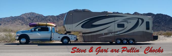
So, off  we go from Vernal toward Moab.  Our system includes a Pilot (Gari) and Navigator/Co-Pilot (Steve).  Gari's job is to safely operate the rig between the ditches, avoid involvement with all bad drivers, and follow all traffic laws.  Steve's job is to provide situational awareness data to the Pilot.  That is announcing upcoming turns and traffic patterns, assistance looking for and reading signs, and calling ahead to potential campsites.  We simply ask if they have vacancy for a 40 ft fifth wheel trailer.  We don't make a reservation, but will pull off the highway when we get to a place that says they have a spot.  If we don't like it, we drive on.  On the way into Moab, the best offer we could get from any campground was dry camping (no hookups) parked in a sand lot for $25 per night.  We decided to stop 50 miles short of Moab in Green River, Utah and stay for a few nights in an uncrowded campground and drive into Moab in just the truck and see what was going on in Moab.

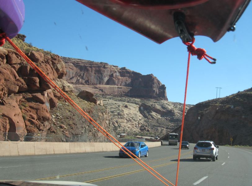
In we drove into Moab.  The rock formations were magnificent and the traffic was significant!
It turns out that September is High Season for Moab and much of Utah's Parks.  That is about the time that the temperatures drop low enough to be tolerable.  The normal summer months that are so popular in most other locations are just too hot in Utah.

Below you can see the traffic jamb lining up to get into Arches National Park.  I think we are going to drive right through Moab and come back perhaps in the spring after we depart Yuma.
South into Moab we continued... look at that unending line of traffic coming north and headed to Arches National Park!  A big crowd like that, not our cup of tea, we will keep driving.
Below is one of the RV Parks that lined the road through Moab.  Too close to a busy highway for us to want to stay more than a night or two.  Plus, all the hook ups are taken.... pass.
And drive we did... we even saw an arch along the road south.  A little window reflection, but you get the idea.
We continued driving another 50 miles south of Moab, to the sleepy little town of Monticello, Utah.  We stayed at a campground that was on a horse ranch not so different from the old Cloverland Ranch.  Casey had 3 horses there that she rode for pleasure just like we used to do.  Gari got up early one morning to catch the sunrise on the mountain and found a small herd of Mule Deer on the property, see the white butts (and black tipped tails)?  Muleys.
One nice day we decided to ride up onto that mountain, mountain, mountain.... Monticello is near 7,000 ft in altitude and the Aspen leaves have started to turn golden.
Up we went along the winding mountain road.
It wasn't long before we began to see lots of Mule Deer and Wild Turkeys.
We stopped at an overlook that had a series of sight tubes pointing out the various mountains and geological points
This one pointed to... well you can read it. 
That's Dead Horse Point
Steve takes a break on the bench...
...whilst Gari lines up another magnificent shot. 
As we wend our way deeper into the canyons, in search of Newspaper Rock, we are confronted by a head bumper of a rock hanging over the Navigator's side of the truck!  Duck!
Safely we made it and there is Newspaper Rock.
Newspaper Rock is a prolific example of petroglyphs left by the Fremont Culture around 1,000 years ago.  Steve reads the newspaper below.
One of our favorite images was the Brave on horse back hunting Elk with his bow and arrow.  We see lots of deer, elk, bear and goat in these images and that still reflects the natural game populations here today.
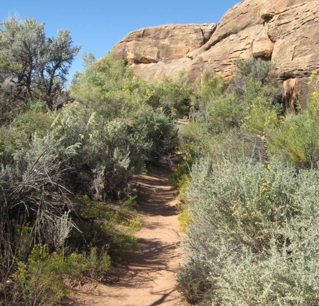
Deeper we drove into the canyons...
We came across a trail that led to an ancient ruin so we walked in to see...
Gari found it about 0.6 mile down the trail.  It was tucked up under a rock overhang.  Below Gari gets the photos of this ruin from around 1200 A.D.
It looked like a giant bird's nest up there.  It was determined that this structure was used for grain storage and that the inhabitants only lived here seasonally, just like the RVers!
Close up of the ancient masonry technique.
We went a little farther into Canyonland National Park and found a trail that led to a Cave Spring.  The bonus is that there was an abandoned cowboy camp and ancient pictographs.  Those are the rock art painted directly onto the rock and not chiseled away like the petroglyphs.  Off we went down the Cave Spring Trail.
Pretty quickly we came upon the old cowboy camp which operated in the mid 1800s all the way up until 1974!  Gari gets some close in shots of the cave accommodations.
I guess it gets you close to the cows, not sure what other compliments to make...
We walked along the rock overhanging cave toward the spring...
 The feeling of having many many tons of rock over our heads felt a little uncomfortable,
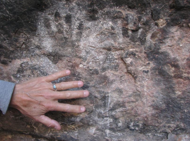
We came upon the pictographs very near the spring.  Gari gets a shot of the hand prints below.
There's a close up of the hand prints, they are much smaller than our hands.
This red image looks like the Kokopelli.
Gari gives a tour of the Cave Spring.
We left the spring to finish the loop trail and came upon two ladders that were part of the trail.  Below Steve goes up the first ladder.
Gari follows right behind.  Steve gets the shot from the top.
One view from up on top of the rock.... but are we really on top?  Maybe not!
Gari looks around the giant rock we seem to be on.
The trail on top of the giant rock is marked by small rock stacks.  You can see one next to Gari below. 
Gari checks her GPS and sure enough we are still in Utah.
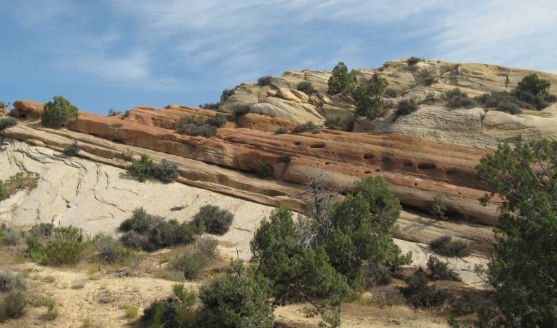
This rock almost made it into the Dinosaur for the Day series.
Another long shot from the top of the trail.
We ended the excursion with a stop at a canyon overlook.  There is Gari below ready to see the fascinating landscape at the overlook.
Looking down into a part of the canyon.
Gari decides to climb up and get a close up and personal view of that big rock.
Interesting giant rock stacks surround the canon view.
Gari reflecting in the cool shade of a day filled with new sights and adventures.


Tuesday, October 4, 2016

Fantasy Canyon and Moonshine Arch

When we said that we were going to go to Utah for the first time, many people remarked, "Oh you're going to go look at the rocks."  Sure enough, Utah has some fascinating rocks and this post highlights two such locations.  Moonshine Arch is not a well known arch and is only about 8 miles north of Vernal, Utah.  Moonshine is on BLM land and has a dirt road leading to the arch from Rt 191.  At first we drove right past the dirt road turn off, but then once we got onto the dirt road it had some signs leading us in the correct direction at the various intersections.

The first thing we saw when we turned onto the dirt road was Molly's Nipple.  Yep that's it below.
We drove as far as we felt comfortable and found a spot to park off the dirt road.  Gari sets her GPS to track for the hike to Moonshine Arch.
Below is a photo of why we stopped.  We decided we didn't want to drive on road conditions like this and thought it may even get worse farther down the road.  We are parked just before the gate at the top of the hill.  Kind of rough we thought...
There goes Gari leading the way from where we parked.
We came to an intersection and a sign, and behind the sign we stumbled across a Geocache.
The Geocache was in a miniature Altoids box.  It had a traveling pin inside.  We pulled out the log sheet and found we were the very first to sign it, Pullin' Chocks 9/2016.
These rocks along the way look like they were molten at one time.  You can see how they oozed into wrinkles.
This rock hill is tilted at an angle, it even looks like it may have cooling bubbles along one edge.  Another explanation could be a variation in hardness in the sandstone and erosion took some material away faster than other.
Before long Gari found the Moonshine Arch.
A view from underneath of the arch.
A view from the cave behind the arch looking back out at Gari underneath.
Steve enters the cave behind the arch for a closer look.
Below is the end of the cave, it didn't go very far back, but looks like it would make a nice shelter.
 Amazing texture and color looking back out the cave in the opposite direction.
Below is a view from underneath the arch looking into the cave.... there goes Steve.
After a good look and walkabout around the Moonshine Arch, we head back down the dusty trail toward a future adventure.
One more excursion in Jensen before heading south to Moab, Utah; it is to a mysterious place named Fantasy Canyon.  There are found other worldly rock formations, some of the legends suggest the underworld.  We know this area was part of the shallow ocean millions of years ago, and the rocks look to us like sandstone erosion by wind and waves.  See what you think...

We drove past Green River...
 ...past the many oil well operations
 ...startled a few Prong Horn Antelope along the way
Until we arrived at Fantasy Canyon.  We parked Pepé and headed toward the strange rock formations...
We weren't sure where the trail was, but we found this small canyon leading upward and thought that a little higher ground may give us a better idea of the area layout, so upward we went.
 The trail became steeper and more treacherous as we proceeded...
We passed mysterious holes as we followed the canyon along its' ups and downs...
 
Stay away from the holes, or be prepared to meet Mr. No Legs!
A gate to Hades?  We don't want to know!
The way up looked treacherous without a clear trail.
 Nevertheless, we picked our way upward and continued...
Steeper and steeper...
We are getting up there now.
Then we finally reached what looked like a goat path very near the top. Baa aaaa aaa...
Now we can see the main Fantasy Canyon!  Can you see the different texture in the ground down below?
Zoom in a bit for a better look.  There!
Gari ponders how will we get down there now?
This game trail looks like it leads down into Fantasy Canyon.
Gari leads the way into Fantasy Canyon.
Fantastic rock formations everywhere we look.
 Incredible!
The shadow and rock look like puzzle pieces.
That looks like a cat sculpture up top.
An interesting cave along the way in the canyon.
A fascinating rock stack.
 Odd rocks...
Odder rocks...
 Oddest of all!
Next stop Moab, Utah... or maybe not...