On to Moab, Utah....or not!
As usual we departed camp not really knowing where we were going to stay. We choose to roll this way for several reasons, in no particular order these reasons are:- It keeps things exciting with that level of uncertainty and then provides a delightful surprise when we do finally land on a spot.
- It removes any worry or pressure on us of making it to a pre-planned destination on a constrained schedule.
- We think that this no reservation approach gives us the best chance to get a good deal and to be satisfied with the campground. Or at least it prevents us from paying ahead, only to arrive and be disappointed with no option of a refund. Once arriving in a new area, we can see how crowded or how well maintained places are, we can't always see that online.
- We are confident in our equipment and our realtime judgement in deciding where to stay and where not to stay, so this gives us great flexibility. Thanks to our self-contained equipment, all we really need is a reasonably flat spot about 80 ft long that is sufficiently off the road and appears to be in a reasonably safe environment. We can sit like that for up to a week if we must.
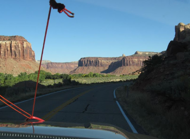
In we drove into Moab. The rock formations were magnificent and the traffic was significant!
It turns out that September is High Season for Moab and much of Utah's Parks. That is about the time that the temperatures drop low enough to be tolerable. The normal summer months that are so popular in most other locations are just too hot in Utah.
Below you can see the traffic jamb lining up to get into Arches National Park. I think we are going to drive right through Moab and come back perhaps in the spring after we depart Yuma.
South into Moab we continued... look at that unending line of traffic coming north and headed to Arches National Park! A big crowd like that, not our cup of tea, we will keep driving.
Below is one of the RV Parks that lined the road through Moab. Too close to a busy highway for us to want to stay more than a night or two. Plus, all the hook ups are taken.... pass.
And drive we did... we even saw an arch along the road south. A little window reflection, but you get the idea.
We continued driving another 50 miles south of Moab, to the sleepy little town of Monticello, Utah. We stayed at a campground that was on a horse ranch not so different from the old Cloverland Ranch. Casey had 3 horses there that she rode for pleasure just like we used to do. Gari got up early one morning to catch the sunrise on the mountain and found a small herd of Mule Deer on the property, see the white butts (and black tipped tails)? Muleys.
One nice day we decided to ride up onto that mountain, mountain, mountain.... Monticello is near 7,000 ft in altitude and the Aspen leaves have started to turn golden.
Up we went along the winding mountain road.
It wasn't long before we began to see lots of Mule Deer and Wild Turkeys.
We stopped at an overlook that had a series of sight tubes pointing out the various mountains and geological points
This one pointed to... well you can read it.
That's Dead Horse Point
Steve takes a break on the bench...
...whilst Gari lines up another magnificent shot.
As we wend our way deeper into the canyons, in search of Newspaper Rock, we are confronted by a head bumper of a rock hanging over the Navigator's side of the truck! Duck!
Safely we made it and there is Newspaper Rock.
Newspaper Rock is a prolific example of petroglyphs left by the Fremont Culture around 1,000 years ago. Steve reads the newspaper below.
One of our favorite images was the Brave on horse back hunting Elk with his bow and arrow. We see lots of deer, elk, bear and goat in these images and that still reflects the natural game populations here today.
Deeper we drove into the canyons...
We came across a trail that led to an ancient ruin so we walked in to see...
Gari found it about 0.6 mile down the trail. It was tucked up under a rock overhang. Below Gari gets the photos of this ruin from around 1200 A.D.
It looked like a giant bird's nest up there. It was determined that this structure was used for grain storage and that the inhabitants only lived here seasonally, just like the RVers!
Close up of the ancient masonry technique.
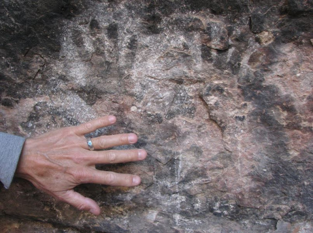
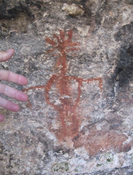
We went a little farther into Canyonland National Park and found a trail that led to a Cave Spring. The bonus is that there was an abandoned cowboy camp and ancient pictographs. Those are the rock art painted directly onto the rock and not chiseled away like the petroglyphs. Off we went down the Cave Spring Trail.
Pretty quickly we came upon the old cowboy camp which operated in the mid 1800s all the way up until 1974! Gari gets some close in shots of the cave accommodations.
I guess it gets you close to the cows, not sure what other compliments to make...
We walked along the rock overhanging cave toward the spring...
The feeling of having many many tons of rock over our heads felt a little uncomfortable,
This red image looks like the Kokopelli.
Gari gives a tour of the Cave Spring.
We left the spring to finish the loop trail and came upon two ladders that were part of the trail. Below Steve goes up the first ladder.
Gari follows right behind. Steve gets the shot from the top.
One view from up on top of the rock.... but are we really on top? Maybe not!
Gari looks around the giant rock we seem to be on.
The trail on top of the giant rock is marked by small rock stacks. You can see one next to Gari below.
Gari checks her GPS and sure enough we are still in Utah.
This rock almost made it into the Dinosaur for the Day series.
Another long shot from the top of the trail.
We ended the excursion with a stop at a canyon overlook. There is Gari below ready to see the fascinating landscape at the overlook.
Looking down into a part of the canyon.
Gari decides to climb up and get a close up and personal view of that big rock.
Interesting giant rock stacks surround the canon view.
Gari reflecting in the cool shade of a day filled with new sights and adventures.


No comments:
Post a Comment