Saturday, August 20, 2016

The Badlands of South Dakota

After leaving Nekoosa, Wisconsin and our visit with Dale, we made our first stop in Sioux Falls, South Dakota... or so we thought.  It turned out we were actually staying in Iowa. Larchwood, Iowa to be precise.  That fills in another state that we have visited in Penelope.  We plan to fill in Utah and depending on the route we choose from South Dakota we may be able to fill in Colorado this year as well.

Larchwood is on the outskirts of  Sioux Falls and in fact where we stayed was just across the road from South Dakota.  We found another casino there in Larchwood, The Grand Falls Casino Resort,  and that is where we parked for two nights of rest.  Interesting contrast here.  This was a high end casino as compared to the Ojibwa Casino we stayed at in Baraga, MI.  Turns out we were much more comfortable at the every-man's place in Baraga.  We talked with the working people in Baraga, we were given free visitor promotions plus free WiFi.  The facility at Baraga was a little older and was not kept quite as meticulously, but it was well maintained and had a warm friendliness about it.  Now the facility at Larchwood was fabulous.  The casino was a huge stone structure, was surrounded by a professional grade championship golf course and had a fancy pool area out back in front of the huge stone mountain water feature.  What a gorgeous place.  We barely spoke with any workers there.  Workers were professional, but certainly no warm friendliness.  Nothing was free, and the charges for any extras were very high.  For example they wanted $10/day for WiFi that didn't even reach the RV parking area.  No thank you.  We walked around the grounds, but didn't even bother to go back inside once we were registered.  The RV lots were still a good deal in Iowa also at $20/day, but no WiFi.  We didn't take a single picture in Larchwood, but we made up for it in the Badlands by taking about a million pics!

We found a private RV park in Interior, South Dakota just about 1 mile from an entrance to the Badlands National Park.  We had to drive through the park in order to get to the campground, so we took that opportunity to purchase our Annual National Park Pass.  Now we can visit all the National Parks and Forests without paying a day use fee each visit.  About a dozen visits pays for the pass.   We hope that we far exceed that number of National Park visits in the next 12 months.

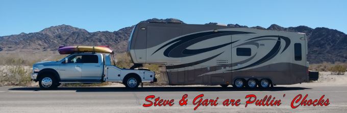
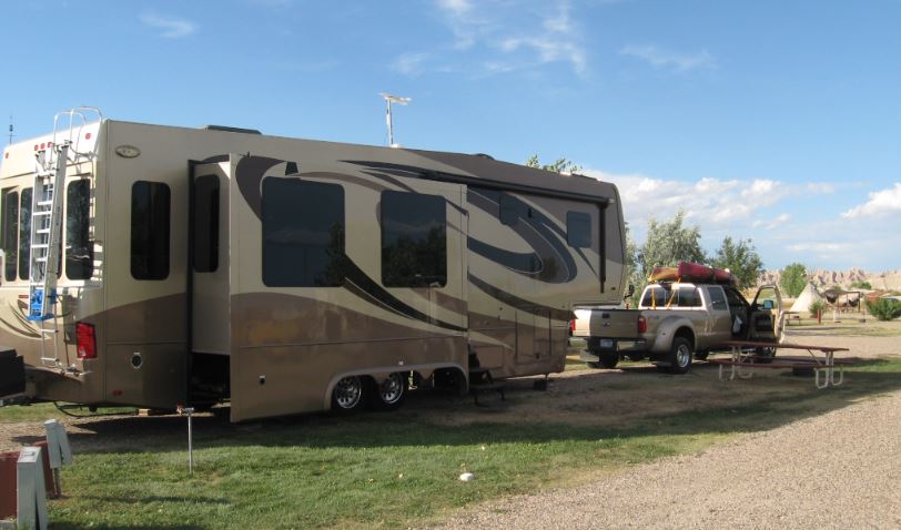
Penelope set up in the Badlands Campground below.  We had a long view of the Badlands from the campground.  You can just see some of the Badlands structure in front of PepĂ© our truck and trusted tow vehicle.
The light makes great differences to the appearance of the Badlands formations.  One evening near sunset there were some scattered showers that moved into the area.  The light from the setting sun was allowed to peek through a number of holes in the clouds and the scenery was upgraded.  Below you can see the various rays of light coming through the blocking storm clouds.
Below are the results of the varied light on the Badlands features looking back to the east.  There were people staying in this TeePee.  I suppose that could be classified as a fancy tent.
Some of the layers of time can be seen in the photo below.
Two layers of Badlands with different light effects.
Three layers of Badlands seen in the various light conditions.
A saddle notch as seen from the campground.
Zoomed in a bit on the notch.
 A rustic last shot from camp.  We liked the fence in the foreground of this shot.  Just one of the million shots we took...
I am not even sure how to introduce the selected pictures from the million taken.  We took 3 or 4 excursions out into the Badlands, but I don't think that matters all that much, the features were magnificent and fascinating everywhere we went.  Some say the Badlands are just a waste land, but are they really?  It sure is beautiful there.
So who knew that the oceans at one time covered this part of our country?  If we read the information correctly that was somewhere around 70 million years ago.
Badlands are a type of dry terrain where softer sedimentary rocks and clay-rich soils have been extensively eroded by wind and water.  They have steep slopes and minimal vegetation.  They can resemble the terrain of volcanic rock.  Canyons, ravines, gullies, buttes, mesas, hoodoos and other such geological forms are common in badlands.  They are often difficult to navigate by foot.  Badlands can have spectacular color displays.

For 11,000 years, Native Americans have used the South Dakota Badlands area for their hunting grounds.  Archaeological records combined with oral traditions indicate that these people camped in secluded valleys where fresh water and game were available year round.  Eroding out of the stream banks today are the rocks and charcoal of their campfires, as well as the arrowheads and tools they used to butcher bison, rabbits, and other game.  From the top of the Badlands Wall, they could scan the area for enemies and wandering herds.  If hunting was good, they might hang on into winter, before retracing their way to their villages along the Missouri River.

About 150 years ago homesteaders began to move into the area.  The fur trappers and traders regularly traveled the 300 miles from Fort Pierre to Fort Laramie along a path which skirted the edge of what is now Badlands National Park.  One trapper found a jaw bone fossil of a Paleotherium, which is thought of as a Tapir or horse like animal.  The White River Badlands of South Dakota have developed an international reputation as a fossil-rich area.  They contain the richest deposits of Oligocene mammals known, providing a brief glimpse of life in this area 33 million years ago.  The fossils found in the Badlands was the main reason for this area becoming a National Park. 
The Badlands are also one of the best examples and opportunity to study erosion.  Can you see Gari way up on that hill?
Gari at the main pull off in the NP. 
The Window Trail at the Main Pull Off.  Gari getting shot out the Window.
Gari on Window Trail.

We saw a Big Horn Ram cross the road and it wasn't a Dodge.
Gari entering Notch Trail from the Main Pull Off.
Interesting erosion formations where the clay adsorbs the water then oozes down the hill, but becomes hardened rock before it arrives at the bottom. 
Gari ascends the rope ladder on Notch Trail
Looking down the ladder from the top.  We will have to go back that way...
 Looking back out the Notch from the top.
At the first overlook.  You can see Interior, SD over the highest peak, that is where our camper is parked.
This looks like a trail spur, let's go in there.
Where now?  Up there?  Yes.
Getting closer to the top...
Gari at the second overlook.  Not much room up there.
Standing at the ledge.
Gari leading the way back out the Notch.
Gari walking carefully along the dangerous cliff.

Gari descending the ladder in the lead.
Examples of erosion.
A tough golf shot; look at this Green placement!
Banded.
Mule Deer; doe and fawn. Look at those ears!
A herd of Big Horns walking single file.
 And Gari.
Next stop, our Rapid City, South Dakota home!


Thursday, August 18, 2016

We made it to central Wisconsin and not too soon.  Apparently we arrived not to long after a severe thunderstorm with very high winds, which caused a bunch of damage in the area.  Our record for good timing continues for now...  We stayed in Nekoosa for a short visit and found our friend Dale holding down the fort in the Deer Trail Campground whilst his dear wife Marlea convalesces at local health facilities.

Below we are taking Dale's lads for a walk.  That's 190 lb Oscar telling us he is going to drive home.  That made all of us laugh including Lenny the other dog in front of Dale and Steve.
Now Oscar is negotiating with his dad Dale if he could at least drive part of the way home... Dale is not having it.
Oscar and Lenny checking out the new stranger on the walk.
As we continue to migrate back to the west, our next key destination is Rapid City, South Dakota, our new home of 2-1/2 years now.  My how time flies!


Sunday, August 14, 2016

On the Arrowhead of Minnesota

Before we left Duluth and Minnesota we yearned to get up into a little bit of the remote country on the Arrowhead of the state that juts out into Lake Superior.  We found a Fish Smokehouse in Knife River, MN and a State Park further north that appeared to have several hiking trails to choose from and off we went.

First stop Gooseberry Falls State Park. Heading up to the Upper Falls and a 1-Mile Hiking Loop to an Overlook at Lake Superior.
We paused at a bronze memorial for the CCC workers of time gone by to appreciate the values and accomplishments of those so dedicated to our country.
Steve on top at the Upper Falls.
The Upper Falls a roarin'
Gari leads the way past the exposed roots to the Overlook Trail.
Lots of Birch way up here.
Gari stopped to investigate one of the trail shelters. 
At the Lake Superior overlook viewing northward.
Gari stands in cooperatively at the overlook.
Heading back a break in the trail growth provides a scenic peek of the river.
A honey bee at work.
On the way back to camp we stopped at the Fish Smoke House in Knife River.  We believe some of the nicest people in the world are found here.... and the best tasting fish!
Steve has his prize back at camp and will eat it outside to spare Gari the olfaction.

The prize revealed, a Smoked Lake Superior Whitefish.  That is one happy man below!
 He ate the whole 1.5 lb treat!

Next Stop Nekoosa, WI to stop in and visit with our pal Wisconsin Dale.