A few hikes around Yellowstone
Upon our first couple of rides into the Yellowstone Park, we were all set to get on some spectacular hiking trails. Surprisingly there seemed to be few defined trails into the back country. What we found were mostly sidewalks and board walks winding through the geothermal and water features. A nice walk, but with hundreds of other visitors and kind of taking the excitement of isolation in the back country away. When we did find a defined trail or two, they were marked with "Closed due to Bear Activity" signs. We thought that it would be best to adhere to the recommendations. We ended up finding several nice trails very near our campground, Yellowstone Valley Inn (YVI).
4 Bear Trail was within walking distance from the YVI where we had the RV parked. We drove the truck over there just to avoid walking on the highway. Gari checks the bulletin board for valuable information before we set off.
We dutifully signed the hikers log sheet, and noticed the couple that hiked there 7 days before us came within 5 feet of a Mountain Lion! We carry a side arm and bear spray, but would prefer to never come close enough to consider using either.
Gari excited to set off down the trail.
The start of the hike was wide open, we like that so we can see all around us.
We got to cross a creek on a toothpick, there goes Steve across now.
Why do the predators have to leave body parts directly on the trail???
Trail marker. When we saw this first one, we didn't notice that the 4 had come off, we thought maybe bear had been spotted there! hahaha You can see it says 4 Bear, but the 4 is barely visible.
The trail is taking us into the mountains there.
Gari checks our position on the GPS all the while has her bear spray at the ready.
Steve's packing.
Looking back toward the trail-head. 4 Bear was a very pleasant and scenic hike.
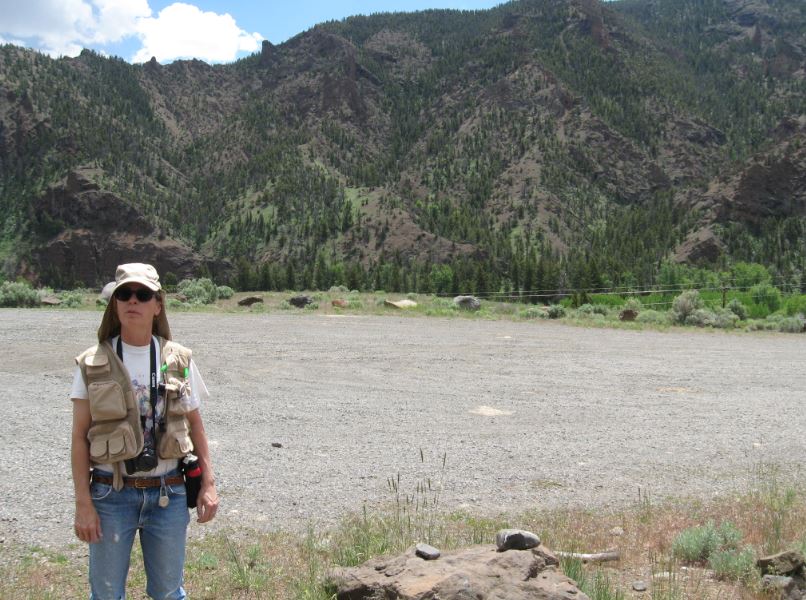
Clearwater Trail was a little farther from YVI. We had heard of bear sightings in this area about a week before this hike. Gari surveys the trail-head area below.
Steve is raring to go and leads the way out.
There will be wild flowers today.
The trail followed a river from above the dense vegetation around the river bed. That is a big reason we selected this hike because it enableg us to see around ourselves. Fewer hiding places for predators.
Wild Daises?
Gari gets a landscape shot.
Nice and open around the trail with lovely flowers. It appears there has been a recent fire here. Perhaps that is what encouraged the flowers.
Lots of pretty wild flowers.
An interesting vertical rock jutting up along the path.
Steve investigates. Rock. No new information.
Gari along the trail on the Clearwater hike.
Steve overlooks the river, which is getting very close to the trail.
Yep, we're in the river bottom now. Lots of vegetation down here. We can't see a thing. We decided not to enter the bushes and turned back here.
We like the scenery in the clear.
Purple flowers.
Jims Creek was the first hike back country we took during our YVI stay. It was across the road from the RV park and a 3 mile head start drive up into the mountains there. We observed a standard bulletin board and pit toilet at the trail-head. Everything a hiker needs.
The view from the trail-head.
Steve pauses for the obligatory trail-head photo. It was crisp that morning and it appears that Steve is packing again.
We noted the bear cautions on the bulletin board, then we see Grizzly tracks not 100 feet into the hike! We stopped, looked, and decided that since this was our first hike after having difficulty finding an open trail, that we were going! And we did. In bear tracks you see the claws on Grizzlies only. The Black Bear doesn't leave claw impressions because their claws are smaller. The Grizzly Bear spends much of their life digging for food.
We are glad we went on, the scenery is spectacular up here!
There was still snow on the mountain tops in early June.
At the top of our hike Steve pauses to use the binoculars.
No caption necessary.
You can see the highway below. YVI and our RV is down there in front of those spires.
Steve soaks in the view from the top of our hike.
We love the Wyoming mountains.
Gari shows her bear spray. Don't mess with her bear!
It would be interesting to hike up in there, but not today.
We observed lots of Elk signs up there that day. My boot is size 13 EE.
As far as the eye can see, or in this case the lens.
We passed a compound that was for sale at the time for a cool $1.4 Million.
On the drive back we stopped and captured this panorama including Pepé and YVI our campgound to the left and below.
Elk Fork was our last documented back country hike. Steve pauses to review the trail-head bulletin board information.
Gari poses for the obligatory trail-head photo.
Elf Fork starts out very pretty.
The trail winds along the, you guessed it, Elk Fork River below.
Gari spots a Cow Moose in the brush below along the river.
Steve meets up with Secret Squirrel.
The moose ambles off into the brush.
Lots of Elk sign here too. Elk Fork, check.
Wonderful wild flowers here today too.
Ahhhh yes.

Steve drops below the trail and gets a shot of Gari above.
Deer jaw... on the trail.
Interesting geology.
Gari stands in front of the rock crease.
We drift up above the trail and get a photo of a horse trail riding group as they pass below us.
Steve wants to drop down and touch the river... there he goes.
He thinks he can get there that way. He keeps going.
Steve came back up quick, he says he saw another fresh carcass down there. Not a good place to hang around, the owner may return.
Gari crosses one of many snow melt streams.
A section of trees and brush we had to go through. We made it safely!
Yeah, yeah, yeah, we know, but we are going to see the sights anyway.