Manistique, Michigan
We Just left the Jack Pine Lodge and Campground which had a Manistique address, but was much closer to Hiawatha, MI and was also in the Hiawatha National Forest.
The Red triangle on the map below locates the Jack Pine Lodge. The little Blue Dot in the upper left is our actual present location, in Baraga, MI on the Keweenaw Bay of Lake Superior.

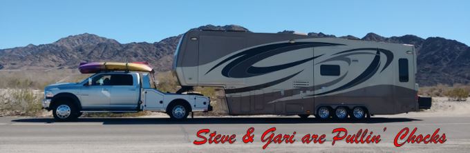
We have fallen into a process here on the Upper Peninsula. Being that this is the height of camping season, the UP is one of few places that is enjoying 70 degree weather and the campgrounds here are fewer and smaller, we have been finding it quite challenging to find "a spot to light". During the week at Jack Pine we used the camp WiFi when we could connect to it and when it was working and we searched for "the next camping spot". There wasn't enough cell signal to make a call or receive browser data, text only and that was iffy and slow. We pulled chocks this morning with options in and around Houghton, MI. When we got into a usable cell signal, Steve the right seat Navigator started calling the various camp options in our prioritized order. We got to about our 4th option and learned that it was a first come first served park. Long story short, we nabbed site #7 at the Ojibwa Casino in Baraga, MI. Looks like our Lucky #7 just came in! There is Penelope in her resting spot for a week.

But I digress, the point of this post was to share some of the sights visited while at Jack Pine Lodge in Manistique. We will share our Baraga adventures that are to be completed at a later time.
From Jack Pine Lodge, we visited a couple nearby camping areas where we thought we may be able to put the kayaks over, but that didn't pan out. A nice walk in the shady cool woods did occur though. First stop Indian Campground, looking for the Indian River.
OK so there is a river...
We don't see a river...
No river here.
Lots of trees, no river.
There's the river! Too far and too steep to drag the kayaks... but we can go to Colwell Lake that will be easier to put the kayaks in.
We got to Colwell Lake around noon and it was too hot to go out on the sunny lake, so we decided to walk the 2 miles around the lake in the shady woods. There was a very nice graveled path.
We saw pretty natural sights. That's Gari by a clump of Birch Trees.
I don't know, but a pine cone is there.
A nice array of leaves with some flowers splashed in.
Looks like the Woodpeckers have been busy
Those are big holes, perhaps a Pileated Woodpecker...
There's the lake, it looks hot out there in the full sun!
We rode into... you guessed it, Manistique to resupply groceries and to see what was there.
We knew there was a Lakeview Park on the shore of Lake Michigan, so there we went.
There is a little surprise in this picture that will show up better in subsequent pictures. Hint, it's between the bushes.

Gnarly.
Wood chip deposits... a legacy of the booming lumber industry in Manistique in the early 1890s. Manistique is located at the mouth of the Manistique River, which helped the five operating sawmills at that time to float logs as big as seven feet in diameter to their mills. These mills produced over five million tons of sawdust and wood chips... which were dumped in the river and Lake Michigan and incredibly enough this debris is still washing up in Manistique today! There is some of it below.
The wood is still in the water, you can see the black area below, that's wood chips!
Steve still wants to get into Lake Michigan!
And here is the shining star of Lakeview Park, the Manistique East Breakwater Lighthouse. That was the little thing peeking out between the bushes in the earlier photo.
It is at the end of a long stone and concrete jetty,
Let's walk out there Gari!
Getting closer.
The Light is automated now and remains in operation for ship traffic.
There was a breeze in the air!
Another day we went north to the Munising, MI area on Lake Superior and walked out to the waterfalls and the famous Pictured Rocks. The Shoreline there is sandstone cliffs with lots of iron and other minerals and these properties give the cliffs magnificent erosional shapes and colors.
There is Steve at Munising Falls.
Another viewing platform at Munising Falls.
Miner's Falls unoccluded.
The top section of Miner's Falls.
The famous Castle Rock along the Pictured Rock National Shoreline.
Close up at the Castle.
Another view of Pictured Rocks. The center section had a recent cave-in of the soft sandstone.
More sandstone magnificence...
Still more... I think it goes on for 60+ miles.
Gari at the Castle. She eluded the camera this day, a shame because she is so much nicer to look at.
Last but not least, we found a nature preserve to the east of Jack Pine called Seney National Wildlike Refuge. We know there had been Black Bear sightings earlier in the week, so that was encouraging. There is a wildlife loop that you drive there similar to that on Assateague at Chincoteague, VA. The Seney Loop has two loops approximately 3 miles each. It was pretty and unspoiled and we have some pictures of it below.
Gari is photographing a Loon below.
That loon had a fish he was eating for lunch.
He's getting ready to gobble it down now.
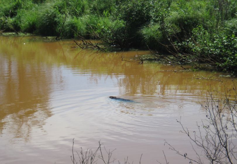
We saw a Beaver! I remember when Jethro Bodine cut down Mr. Drysdale's Cedar Tree to make a box for Granny's birthday. Jethro told Uncle Jed that he, "knawed the stump good so it looked like a Beaver done it!" Glad I remembered that. .....that's a question.
One of the many lakes on the refuge.
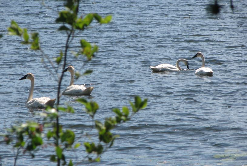
There were lots of Swans.
Eagle eye Gari spotted a pair of Sandhill Cranes waaaaay off in the marsh. Her zoom lens pulled them in for viewing.
At first they look like turkeys, but they stand well over 3 ft tall and their beak is crane like.
Looks like a good place for a bear, but no bear today.


No comments:
Post a Comment