Moonhouse Ruins
This was a favorite hike of ours during our stays around Utah. We saw it written that Moonhouse Ruins are the best in the state of Utah. Well we sure wanted to see that! We stopped at the Ranger Station to get info on the hike one day and we found out that only 20 people per day are permitted to hike into Moonhouse and that people line up at 7:30 AM, even before the Ranger Station opens. They also told us we could call and make a reservation over the phone. That sounded much better since we were staying an hours drive from the ranger station. We looked at the weather forecast and picked our day. We called and then were told that the reservations had to be four or more days in advance. We picked another day farther out and called back... no answer. We called again later and got through. It turned out that we got the last two spots for the day farther out. We were so excited.
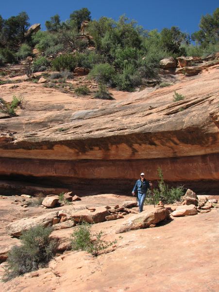
Below is a preview from the hike. Gari made it down a scramble spot.
The first leg of the hike was about an 8 mile drive off road. We only hit a couple real rocky spots, most of the trip was a narrow dirt road like you see below.
We made the 8 slow miles successfully and parked in the designated area in the middle of nowhere.
There was another 1.2 mile road that we elected not to attempt in the truck, and we were glad we made that decision.We hoofed it to the end of that road.
We saw this horned toad on this leg of the hike. Probably would have squished him if we had driven.
We arrived at the off-off road parking to see the absolute trail-head. No vehicles beyond this point.
We know the drill from here very well, follow the rock cairns!
Down we go... we have to get across a good sized canyon and the only way we know is down then back up.
There's the canyon, gee it is big... We didn't realize it right away, but you can actually see some of the ruins from here, binoculars helped. They are too small in this picture to see.
Gari approaches the most difficult scramble spot... We followed this experienced hiking couple from San Diego for a little while, then they left us in the dust!
There goes Gari!
Gari photographs Steve as he follows right behind.
We walked along a shelf for a while...
There goes Gari out front and leading the way.
We are much closer now and we can see the ruins across the narrow part of the canyon tucked into the rock creases.
Alright the bottom of the canyon! Now just climb up to the ruins. Then do it all backwards again to get back to the truck! Excuse me Gari, do you see that huge balanced rock up there?
Making our way through the bottom of the canyon to the path upward...
Gari going up...
We must be on trail, there's a cairn.
Still farther up...
Getting closer, we can see the ruins much better now.
Almost there.
We have arrived! Amazing! We see some painted adornment above the wall.
A little closer, some ceiling border and a snake pictograph.
This area is like a hotel. It has a front door, and the room doors are inside the foyer.
Below is one of the inside rooms. We can see the rock walls inside a little bit.
Gari and another visitor inspect the hand prints above one of the outside kivas.
Up close on the hand prints in the adobe mud.
This little kiva has a front porch.
Gari peeks out from inside the "hotel door".
A shot down the hotel foyer. You can see several rooms here.
This is the room at the end of the hall.
Steve crawled back there and took a flash picture of the interior of the room.
These kivas in the hotel foyer have painted decoration similar to that outside by the snake pictograph.
We walked along the canyon and came across these kivas.
Gari gets a shot from below by the big balancing rock we saw from the canyon bottom.
The other side of the balancing rock.
Gari finds another kiva.
We kept walking to see what else there was to see.
This kiva appears to suffered a nearby rock slide.
More ruins ahead!
Gari investigates inside.
The masonry work is very precise on this multifamily dwelling.
There are even decorative stone integrated into these units.
The decorative stones are on the inside as well!
Such style.
The door headers were often wooden sticks, sometimes lashed together with native twine.
Fancy natural ceiling texture on this crumbling kiva.
Below is as far as we went before turning back. We are certain there are more ruins out there...
Back to the canyon bottom and the balancing rock which points the way out.