Corona and Bowtie Arches
This is one of the best hikes in the Moab area, but it is not within the famous Arches National Park. We rode out highway 269 from Moab which runs along the Colorado river in an impressive canyon section of river. A bonus to the magnificent sheer rock cliffs, there is ancient rock art along the way. You know we can't pass up a petroglyph!
View along Highway 269.
Pepé parked at the rock art panels on Highway 269.
This panel appears to be a line of people, with a goat in the picture.
Looking straight up the sheer cliff.
A busy panel with figures going all the way to the bottom of the frame.
When we arrived at the Corona Arch trailhead the first thing we had to do was cross the railroad tracks emerging from solid rock.
Gari at the start of the trail.
Steve going up the steep section aided by the steel hand hold cable.
Gari passes the next obstacle, a ladder bolted to the rock, with relative ease.
Steve changes his camera batteries at the top of the ladder.
Gari gets a hero shot of Steve in the foreground of Corona Arch.
Steve gets a shot of both Bowtie and Corona Arches, with a flashing glimpse of hiker Gari...
Gari pauses to get a shot of Bowtie Arch. They call this type of arch a pothole arch. Water collects in a depression above. The freezing and thawing slowly erodes the depression until it breaks through and forms a pothole arch.
Nice shot Gari.
Corona Arch is just to the right of Bowtie.
Gari strolls under Corona Arch.
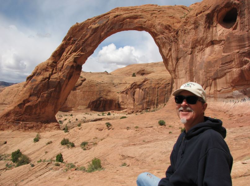
Steve's turn under the arch.
Looking back at the entire Corona Arch.
We had a little picnic right there.
That is the view from our picnic spot looking down the canyon. You can see the train tracks below.
We saw a spot that had many rock cairns. People love to stack rocks and this is proof.
One last view looking back at Corona and Bowtie Arches as we return to prepare for the next outing.


No comments:
Post a Comment