Prescott Valley, Arizona
We finally arrived in sunny Arizona after the colder weather chased us all the way from our starting location in Yakima, Washington. Our timing was a little better this year as we departed Yakima before September ended and only encountered snow in the higher elevations as we made our way south. We did see frost and ice on several mornings, but the thin dry air in these higher western altitudes permits the sun to warm things up quickly each day and melt any over night frost or ice very quickly.We found a good location in Prescott Valley at the Yavapai County Fairgrounds. The facility is fairly new, so the sites are plenty large and the utilities are in good condition. The location is on the way to Jerome and Sedona where we did most of our hiking/exploring on this visit. Shopping in Prescott Valley and Prescott was not too far from our campsite either. We planned to stay a month, but the weather turned colder a bit earlier than usual and we even had snow; so we left two weeks early and continued south to Sun City, AZ. More about Sun City in a later post.
Our first excursion was to the Mingus Mountain Recreation Area a National Forest Service Park. It is in the Black Hills mountain range east of Prescott Valley and on the way to Sedona.. We hiked around the area and enjoyed some nice mountain scenery, shared in pictures below.
Plaque mounted at the Hang Glider Launch Ramp
Gari at the launch ramp.
Launch ramp view to the north. That is the town of Cottonwood, AZ in the valley below.
Launch ramp view to the south.
We found a USGS Benchmark near the launch ramp. We see many of these in our National Parks and Forests. This benchmark surveys this Mingus location in at 7,721 ft above sea level.
We had lunch at the location below which is south of the hang glider ramp. We met a couple from Michigan there. They said they bought a home in Prescott Valley about 10 years ago and spend the winters there in AZ. They told us about a lesser known overlook point near the hang glider ramp. That became our mission to find the overlook after lunch. Gari at our picnic spot.
View of the valley from the picnic site. We believe the large mountain in the distance is Humphreys Mountain, rising above 12,000 ft and about 100 miles away in this picture. That is just north of Flagstaff, AZ.
We began searching for the trail to the overlook, but were having trouble finding it. I think we were blazing our own trail below.... look out for the cactus!
Closer up... clearly a sticky situation.
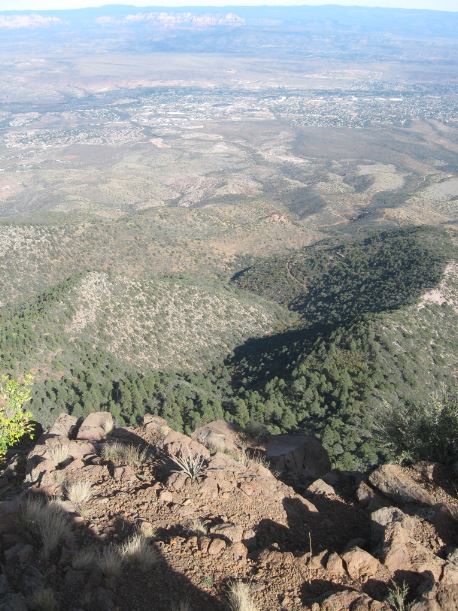
Long story short, we found the overlook!
A great view from this perch, just like the Michigan folks told us.
Cottonwood AZ below.
We found the real trail as we returned, you can see the rock line guiding travelers on the path.
We will visit Sedona next time.


No comments:
Post a Comment